
Explore the world of spatial analysis and cartography with geographic information systems (GIS). In this class you will learn the basics of the industry’s leading software tool, ArcGIS, during four week-long modules:
Week 1: Learn how GIS grew from paper maps to the globally integrated electronic software packages of today. You will install ArcGIS on your computer and learn how to use online help to answer technical questions.
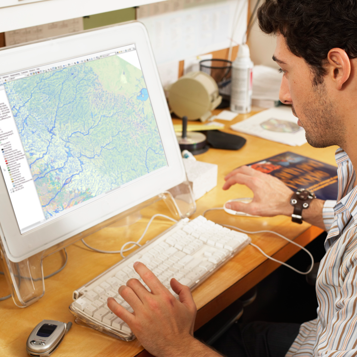
Week 2: Open up ArcGIS and explore data using ArcMap. Learn the foundational concepts of GIS, how to analyze data, and make your first map.
Read more
Explore the world of spatial analysis and cartography with geographic information systems (GIS). In this class you will learn the basics of the industry’s leading software tool, ArcGIS, during four week-long modules:
Week 1: Learn how GIS grew from paper maps to the globally integrated electronic software packages of today. You will install ArcGIS on your computer and learn how to use online help to answer technical questions.
Week 2: Open up ArcGIS and explore data using ArcMap. Learn the foundational concepts of GIS, how to analyze data, and make your first map.
Week 3: Make your own maps! Symbolize data and create an eye-catching final product.
Week 4: Share your data and maps and learn to store and organize your data.
Take Fundamentals of GIS as a standalone course or as part of the Geographic Information Systems (GIS) Specialization. By completing the first class in the Specialization you will gain the skills needed to succeed in the full program.
Students who need an ArcGIS license will receive a non-commercial, 1 year student license for participation in this course and specialization.
Here's a deal for you
What's inside
Syllabus
Course Introduction and Introduction to Geographic Information Systems (GIS)
In this module, we will cover course expectations, give you a quick overview of GIS and what's great about it, take a first look at ArcGIS Pro and identify key elements in the interface, and define core geospatial concepts and terminology. In Section 2, we will discuss options for desktop GIS, the history of GIS and how it's used today, discuss resources and help that you can use, and lay out core skills that are relevant to you as a GIS analyst. We'll close out by showing you how to get a copy of ArcGIS Pro for this course, and with a tutorial on getting started in ArcGIS.
Read more
Syllabus
Traffic lights
Save this course
Reviews summary
Fundamentals of gis: solid basics with software challenges
Activities
Practice Map Creation and Symbology
Show steps
Gain hands-on experience with GIS software through map creation and symbology exercises.
Show steps
-
Open ArcGIS and explore its interface.
-
Load sample data and create a new map.
-
Apply different symbology to data layers to visualize information.
-
Save and export the created map.
Attend GIS Industry Events
Show steps
Network with professionals and learn about the latest trends in the GIS industry.
Show steps
-
Identify local GIS conferences, meetups, or workshops.
-
Attend events, connect with professionals, and exchange ideas.
-
Gain insights into real-world GIS applications and career opportunities.
Explore Advanced GIS Techniques
Show steps
Expand knowledge of GIS techniques beyond the scope of the course through guided tutorials.
Show steps
-
Identify areas of interest or specific skills to improve.
-
Search for and select reputable tutorials or online courses.
-
Follow the tutorials, experiment with different tools and techniques.
-
Apply new skills to personal projects or assignments.
Show all three activities
Practice Map Creation and Symbology
Show steps
Gain hands-on experience with GIS software through map creation and symbology exercises.
Show steps
- Open ArcGIS and explore its interface.
- Load sample data and create a new map.
- Apply different symbology to data layers to visualize information.
- Save and export the created map.
Attend GIS Industry Events
Show steps
Network with professionals and learn about the latest trends in the GIS industry.
Show steps
- Identify local GIS conferences, meetups, or workshops.
- Attend events, connect with professionals, and exchange ideas.
- Gain insights into real-world GIS applications and career opportunities.
Explore Advanced GIS Techniques
Show steps
Expand knowledge of GIS techniques beyond the scope of the course through guided tutorials.
Show steps
- Identify areas of interest or specific skills to improve.
- Search for and select reputable tutorials or online courses.
- Follow the tutorials, experiment with different tools and techniques.
- Apply new skills to personal projects or assignments.
Career center
GIS Analyst
Cartographer
Geographer
Urban Planner
Environmental Scientist
Data Analyst
Web Developer
GIS Technician
Project Manager
Business Analyst
Teacher
Journalist
Researcher
Policy Analyst
Sales Representative
Reading list
Share
Similar courses
OpenCourser helps millions of learners each year. People visit us to learn workspace skills, ace their exams, and nurture their curiosity.
Our extensive catalog contains over 50,000 courses and twice as many books. Browse by search, by topic, or even by career interests. We'll match you to the right resources quickly.
Find this site helpful? Tell a friend about us.
We're supported by our community of learners. When you purchase or subscribe to courses and programs or purchase books, we may earn a commission from our partners.
Your purchases help us maintain our catalog and keep our servers humming without ads.
Thank you for supporting OpenCourser.