Photogrammetrist
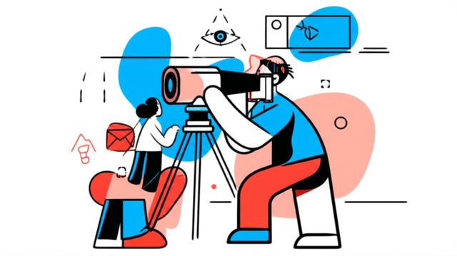
Photogrammetrist: Mapping the World in 3D
Photogrammetry is the science and technology of obtaining reliable information about physical objects and the environment through the process of recording, measuring, and interpreting photographic images and patterns of electromagnetic radiant energy and other phenomena. At its core, a Photogrammetrist uses photographs, often taken from aircraft, drones, or ground-based cameras, to create detailed 3D models, maps, and measurements of the real world. Think of it as creating a highly accurate digital replica of a place or object using pictures as the primary source of data.
This field blends principles from optics, geometry, computing, and image analysis. Professionals in this role are responsible for planning data acquisition missions, processing the collected imagery using specialized software, analyzing the results, and producing deliverables like orthophotos (geometrically corrected aerial images), digital elevation models (DEMs), 3D point clouds, and detailed topographic maps. It's a career that requires both technical skill and a keen eye for detail.
Working as a Photogrammetrist can be incredibly engaging. You might find yourself creating detailed models of historical sites for preservation, mapping terrain for large construction projects, or analyzing environmental changes over time using satellite or drone imagery. The ability to transform simple photographs into complex, measurable 3D information offers a unique perspective on the world and plays a crucial role in decision-making across many sectors.
Introduction to Photogrammetrists
What is Photogrammetry and What Do Photogrammetrists Do?
Photogrammetry, put simply, is the science of making measurements from photographs. Photogrammetrists apply this science to extract the geometric properties of objects or scenes from photographic images. Their primary responsibility is to turn 2D images into accurate 3D spatial information. This involves careful planning of how images are captured, ensuring sufficient overlap and appropriate angles to enable 3D reconstruction.
Once images are acquired, photogrammetrists use sophisticated software to identify common points across multiple photos. Through principles like triangulation, similar to how our own eyes perceive depth, the software calculates the 3D coordinates of these points. This process generates dense point clouds, textured 3D meshes, or orthorectified images which serve as the basis for maps, models, and various spatial analyses.
Daily tasks might include operating cameras or sensors (sometimes mounted on drones or aircraft), processing large datasets, performing quality control checks to ensure accuracy, interpreting spatial data, and collaborating with engineers, surveyors, archaeologists, or environmental scientists who rely on the generated geospatial products.
A Brief History of Measuring with Light
The concept of using perspective geometry to map objects dates back centuries, but photogrammetry as a distinct field emerged with the advent of photography in the mid-19th century. Early pioneers recognized the potential of photographs to capture precise measurements of terrain and architecture. French officer Aimé Laussedat is often considered the "father of photogrammetry" for his work in the 1850s using terrestrial photographs for topographic mapping.
The development of aviation in the early 20th century revolutionized the field, allowing for aerial photogrammetry. This enabled large-scale mapping projects that were previously impractical. World Wars I and II spurred significant advancements in aerial reconnaissance and mapping techniques, leading to the development of specialized cameras and plotting instruments.
The digital revolution beginning in the late 20th century brought further transformation. Film was replaced by digital sensors, and complex optical-mechanical plotters gave way to powerful computer software. The rise of algorithms like Structure from Motion (SfM) and Multi-View Stereo (MVS), combined with increased computing power, has made photogrammetry more automated, accessible, and widely applicable than ever before.
This course explores the history of navigation, a field closely related to the development of mapping and spatial measurement techniques.
Where are Photogrammetrists Needed?
Photogrammetrists are employed across a diverse range of industries where accurate spatial information is critical. Engineering and construction firms rely heavily on photogrammetric surveys for site planning, progress monitoring, and volume calculations. Surveying and mapping companies utilize photogrammetry for creating topographic maps, boundary surveys, and property assessments.
Geographic Information Systems (GIS) heavily integrate photogrammetrically derived data, such as orthophotos and elevation models, as foundational layers for spatial analysis. Urban planning and resource management agencies use this data for infrastructure development, environmental monitoring, and land use planning. The field also finds applications in archaeology for documenting excavation sites and artifacts, in forensics for crime scene reconstruction, and in entertainment for creating realistic 3D environments and visual effects.
Furthermore, disaster management agencies use rapid mapping techniques based on photogrammetry to assess damage and coordinate response efforts after natural disasters. The versatility of photogrammetry ensures its relevance in any field requiring precise measurement and modeling of the physical world.
Core Techniques and Tools
Capturing the World: Aerial vs. Terrestrial Methods
Photogrammetric data acquisition primarily falls into two categories: aerial and terrestrial (or close-range). Aerial photogrammetry involves capturing images from airborne platforms like airplanes, helicopters, or, increasingly, Unmanned Aerial Systems (UAS), commonly known as drones. This method is ideal for mapping large areas, creating topographic maps, monitoring land use changes, and surveying inaccessible terrain.
Terrestrial photogrammetry, conversely, uses ground-based cameras. This could involve handheld cameras, cameras mounted on tripods, or even mobile mapping systems attached to vehicles. This approach provides higher detail and accuracy for smaller areas or specific objects, making it suitable for architectural documentation, archaeological artifact recording, industrial inspection, and accident reconstruction.
The choice between aerial and terrestrial methods depends on the project's scale, required accuracy, site accessibility, and budget. Often, projects benefit from integrating data from both perspectives to achieve comprehensive coverage and detail.
These courses offer insight into aerial data capture methods, including UAS fundamentals and drone business operations.
The Digital Toolbox: Software Essentials
Modern photogrammetry relies heavily on specialized software to process imagery and generate 3D data. Key software categories include:
- Photogrammetry Suites: Tools like Agisoft Metashape, Pix4Dmapper, and RealityCapture automate the workflow from image alignment and point cloud generation to mesh creation, texturing, and orthomosaic production.
- GIS Software: Platforms such as ArcGIS and the open-source QGIS are essential for integrating, analyzing, and visualizing photogrammetric outputs within a broader geographic context. They are used for creating maps, performing spatial analysis, and managing geospatial databases.
- CAD and 3D Modeling Software: Programs like AutoCAD, Revit, or Blender are often used to further refine 3D models, extract specific measurements, integrate designs, or prepare data for visualization or 3D printing.
Familiarity with these software types is crucial. Processing involves steps like camera calibration, image orientation, dense point cloud generation using Structure from Motion (SfM) and Multi-View Stereo (MVS) algorithms, mesh generation, and texture mapping. Proficiency requires understanding both the software operations and the underlying photogrammetric principles.
These courses provide foundational knowledge in GIS and related image processing techniques, which are integral to a photogrammetrist's software toolkit.
Eyes in the Sky and On the Ground: Hardware Requirements
The quality of photogrammetric output is directly linked to the quality of the input imagery and the hardware used. Key hardware includes:
- Cameras: High-resolution digital cameras (DSLRs, mirrorless, or specialized metric cameras) are fundamental. Factors like sensor size, lens quality, and geometric stability are important considerations.
- UAS/Drones: Drones equipped with GPS/GNSS receivers and suitable cameras have become ubiquitous for aerial data acquisition, offering flexibility and cost-effectiveness for many projects.
- LiDAR Sensors: While distinct from photogrammetry, Light Detection and Ranging (LiDAR) is often used in conjunction. LiDAR directly measures distances using laser pulses, generating highly accurate point clouds, especially for capturing ground elevation beneath vegetation. Both aerial (ALS) and terrestrial (TLS) LiDAR systems exist.
- GPS/GNSS Equipment: Accurate ground control points (GCPs) measured with survey-grade GPS/GNSS receivers are often necessary to georeference the photogrammetric model accurately within a real-world coordinate system.
- Computers: Processing large photogrammetric datasets requires significant computational power, including fast processors, ample RAM, and capable graphics cards (GPUs) to accelerate processing.
Understanding camera fundamentals and imaging principles is essential for selecting and utilizing hardware effectively.
Selecting the right combination of hardware depends on the specific application, desired accuracy, budget, and operational constraints. Technological advancements continuously improve the capabilities and accessibility of these tools.
Formal Education Pathways
Building the Foundation: Relevant Degrees
A bachelor's degree is typically the minimum educational requirement for entry-level positions as a photogrammetrist or in closely related fields. Relevant degree programs provide the necessary theoretical background in mathematics, physics, computer science, and spatial sciences. Common choices include:
- Geomatics or Geomatics Engineering: This is often considered the most direct pathway, focusing specifically on spatial data acquisition, processing, analysis, and management, including surveying, GIS, remote sensing, and photogrammetry.
- Surveying or Surveying Engineering: These programs emphasize precise measurement techniques, legal aspects of boundaries, and data collection, often incorporating photogrammetry as a key tool.
- Geography with a GIS/Remote Sensing concentration: Geography programs provide a broader understanding of spatial patterns and processes, with specializations offering technical skills in mapping and spatial analysis technologies.
- Civil Engineering: Some civil engineering programs offer surveying or geospatial tracks that cover photogrammetric principles relevant to infrastructure projects.
- Computer Science: A background in computer science can be advantageous, particularly for roles involving software development, algorithm research, or processing large datasets, especially with a focus on computer vision or image processing.
Regardless of the specific degree title, coursework should ideally cover topics like surveying principles, coordinate systems, map projections, remote sensing, image processing, statistics, calculus, linear algebra, and GIS fundamentals.
Advanced Studies and Research
For those interested in research, development, or specialized applications, pursuing a Master's or Ph.D. degree can open doors to advanced opportunities. Graduate programs allow for deeper dives into specific areas like advanced photogrammetric algorithms, sensor development, integration with AI/machine learning, LiDAR processing, or specialized applications in fields like environmental science or cultural heritage.
Research opportunities often exist within university labs focusing on geospatial science, computer vision, or remote sensing. These might involve developing new methods for 3D reconstruction, automating feature extraction, improving sensor calibration techniques, or applying photogrammetry to novel scientific questions. A graduate degree is often necessary for teaching positions at the university level or for leading research initiatives in government agencies or private companies.
Advanced studies often involve working with complex datasets and cutting-edge technologies. This course delves into 3D reconstruction from multiple viewpoints, a core concept in advanced photogrammetry.
Understanding related fields like computer vision is also beneficial. These books offer in-depth theoretical knowledge relevant to advanced study and research.
Certifications and Professional Standing
While not always mandatory, professional certifications can enhance a photogrammetrist's credentials and demonstrate a high level of competency. The most recognized certification body in the United States is the American Society for Photogrammetry and Remote Sensing (ASPRS). ASPRS offers several certifications relevant to the field.
ASPRS certifications include Certified Photogrammetrist (CP), Certified Mapping Scientist (with specializations in Remote Sensing, GIS/LIS, or LiDAR), and Certified Technologist (in similar specializations). The "Scientist" level certifications, like the CP, typically require a combination of education and significant professional experience (often six years, with three in a position of responsibility), along with passing a rigorous examination. The "Technologist" level requires less experience (typically three years). These certifications often require ongoing professional development for renewal, ensuring practitioners stay current.
Another relevant certification is the GIS Professional (GISP) from the GIS Certification Institute (GISCI), which validates broader competence in geographic information science and technology. While not specific to photogrammetry, it's highly valued in the geospatial industry where photogrammetric data is frequently used.
Holding a certification can be advantageous for career advancement, particularly for consulting roles or positions requiring demonstrated expertise. Requirements generally include meeting specific educational and experience thresholds, providing professional references, adhering to a code of ethics, and passing an exam.
Self-Directed and Online Learning
Learning with Open-Source Tools
The rise of powerful open-source software has created accessible pathways for learning photogrammetry and related geospatial skills. Tools like QGIS (for GIS), CloudCompare (for point cloud editing), and libraries like OpenCV (for computer vision tasks) provide robust capabilities without expensive licenses. Learners can gain practical experience by working through tutorials, contributing to projects, and experimenting with publicly available datasets.
Engaging with open-source communities through forums, mailing lists, and online groups offers valuable support and learning opportunities. While mastering these tools requires dedication, they provide a low-cost entry point for developing fundamental skills in data processing, analysis, and visualization relevant to photogrammetry.
Online courses often leverage these open-source tools, providing structured learning experiences. They can be an excellent way to build foundational skills or supplement formal education. OpenCourser provides a platform to explore various technology courses, including those focused on specific software or programming languages relevant to the field.
This book provides practical examples using the OpenCV library, a cornerstone of many computer vision and image processing tasks related to photogrammetry.
Hands-On Learning: The Power of Projects
Theoretical knowledge is essential, but practical application solidifies understanding in photogrammetry. Undertaking personal projects is an invaluable way to learn. Start small: capture images of an object with your smartphone or a basic camera, ensuring good overlap, and process them using free or trial versions of photogrammetry software. Analyze the results, identify challenges (e.g., poor lighting, lack of texture), and iterate.
As skills develop, tackle more complex projects. Map a small park using drone imagery (ensure you follow local regulations), model a building facade, or experiment with different processing parameters to see their effect on accuracy and detail. Document your workflow and results; creating a portfolio of projects demonstrates practical capability to potential employers.
Project-based learning allows you to encounter real-world problems and develop troubleshooting skills. It transforms abstract concepts into tangible outcomes, making the learning process more engaging and effective. Many online courses incorporate project work to provide this hands-on experience.
These courses focus on practical applications and geospatial analysis, encouraging a project-based learning approach.
Online Courses: Supplementing and Upskilling
Online learning platforms offer a wealth of resources for aspiring and practicing photogrammetrists. Courses range from introductory GIS and remote sensing principles to specialized training in specific software (like Pix4D or ArcGIS) or techniques (like drone mapping or LiDAR processing). These can be invaluable for building foundational knowledge, supplementing a formal degree program, or upskilling in specific areas relevant to your career goals.
For career changers, online courses provide a flexible and often affordable way to acquire necessary skills without committing to a full-time degree program immediately. For professionals already in the field, they offer opportunities to stay current with rapidly evolving technologies and software updates. Look for courses that offer hands-on exercises, real-world datasets, and ideally, some form of certification upon completion.
Platforms like OpenCourser aggregate offerings, allowing you to search for courses specific to photogrammetry or related fields like Remote Sensing and GIS. Remember that while online courses provide knowledge, demonstrating practical application through projects or work experience is crucial for bridging the gap to industry requirements. The OpenCourser Learner's Guide offers tips on how to structure your self-learning journey effectively.
These courses cover essential remote sensing and GIS concepts, suitable for online learning to build a solid foundation.
These books offer comprehensive coverage of digital image processing, a core component of photogrammetry, suitable for self-study alongside online courses.
Career Progression for Photogrammetrists
Starting Out: Entry-Level Opportunities
Graduates with a relevant bachelor's degree typically enter the field in roles such as Photogrammetric Technician, GIS Technician, Survey Technician, or Junior Analyst. Initial responsibilities often involve assisting senior staff with data processing, performing quality control checks, operating software under supervision, digitizing features from imagery, and perhaps assisting with fieldwork or data acquisition.
These entry-level positions provide crucial hands-on experience with industry-standard software, workflows, and project requirements. It's a period focused on building technical proficiency, understanding project lifecycles, and learning practical application of theoretical knowledge. Strong attention to detail, good computer skills, and a willingness to learn are key attributes for success at this stage.
Employers often look for familiarity with specific software (e.g., ArcGIS, Pix4D, Metashape) and foundational knowledge of surveying and mapping principles. Internships completed during studies can provide a significant advantage when seeking these first roles.
Advancing the Career: Senior Roles and Specialization
With several years of experience, photogrammetrists can advance to more senior roles. This might involve becoming a Senior Photogrammetrist, Project Manager, Lead GIS Analyst, or Remote Sensing Specialist. Responsibilities at this level often include leading projects, managing teams of technicians, developing complex data processing workflows, ensuring adherence to accuracy standards, liaising with clients, and making critical technical decisions.
Specialization becomes more common at this stage. One might focus on aerial triangulation, LiDAR data fusion, specific industry applications (e.g., transportation, forestry, mining), software development, or research and development (R&D). Pursuing advanced degrees or professional certifications (like the ASPRS Certified Photogrammetrist) can facilitate progression into these more specialized and senior positions.
Strong analytical, problem-solving, and communication skills become increasingly important. Senior professionals often need to mentor junior staff, present findings to stakeholders, and stay abreast of technological advancements impacting the field.
This book defines key terms used across computer vision and image processing, useful for professionals engaging in specialized discussions or documentation.
Branching Out: Cross-Disciplinary Transitions
The skills developed as a photogrammetrist are transferable to various related fields. The strong foundation in spatial data handling, image analysis, and computational methods opens doors to transitions into areas like:
- Data Science: Experience with large datasets, scripting (e.g., Python), and analytical software provides a good base for roles involving spatial data science or geospatial analytics.
- Computer Vision Engineering: For those with strong programming skills and interest in algorithms, roles focused on developing or implementing computer vision solutions (e.g., automated feature recognition, 3D modeling algorithms) are a possibility.
- Software Development: Contributing to the development of GIS, photogrammetry, or remote sensing software requires a blend of domain knowledge and coding expertise.
- Urban Planning or Environmental Consulting: Combining photogrammetry skills with expertise in these domains can lead to specialized consulting roles.
- Surveying Management or Business Ownership: Experienced photogrammetrists may move into management within surveying/mapping firms or start their own specialized geospatial services company.
Continuous learning and potentially acquiring additional qualifications (e.g., programming skills, domain-specific knowledge) can facilitate these transitions. The core ability to derive meaningful information from imagery and spatial data remains a valuable asset across many technical and analytical disciplines.
Industry Applications and Case Studies
Mapping the Environment: Monitoring and Change Detection
Photogrammetry plays a vital role in environmental science and resource management. Aerial and satellite imagery, processed using photogrammetric techniques, allows for the creation of detailed baseline maps and the monitoring of environmental changes over time. Applications include tracking deforestation rates, monitoring glacier retreat, mapping coastal erosion, assessing wildfire damage, and monitoring vegetation health.
Repeat surveys using drones or satellites enable the creation of time-series data, highlighting trends and quantifying changes in land cover, topography, or water bodies. Digital Elevation Models (DEMs) derived from photogrammetry are crucial for hydrological modeling, landslide risk assessment, and habitat mapping. The ability to cover large and often remote areas efficiently makes it an indispensable tool for environmental researchers and management agencies.
These courses explore the use of remote sensing, including Synthetic Aperture Radar (SAR), for environmental applications like ecosystem monitoring.
Rapid Response: Mapping for Disaster Management
In the aftermath of natural disasters like earthquakes, floods, or hurricanes, rapid and accurate situational awareness is critical for effective response and recovery efforts. Photogrammetry, particularly using drones, enables the quick acquisition of high-resolution imagery over affected areas. This data can be processed rapidly to generate up-to-date maps showing the extent of damage, identifying accessible routes, locating damaged infrastructure, and assessing the impact on communities.
Orthomosaics and 3D models provide valuable visual context for emergency responders, helping them prioritize efforts and allocate resources efficiently. Comparing pre- and post-disaster imagery allows for quantitative damage assessment. Technologies like Synthetic Aperture Radar (SAR), which can penetrate clouds and operate day or night, complement optical photogrammetry in disaster scenarios, providing crucial information even in adverse weather conditions.
This course specifically covers the use of SAR technology for monitoring hazards, relevant to disaster management applications.
Unearthing the Past: Documenting Archaeological Sites
Photogrammetry has revolutionized archaeological documentation and analysis. Close-range photogrammetry allows for the creation of highly detailed, accurate 3D models of artifacts, features, and excavation units without physical contact, preserving fragile contexts. Aerial photogrammetry using drones provides efficient mapping of entire archaeological sites and landscapes, revealing subtle topographic features or settlement patterns not easily visible from the ground.
These 3D models serve multiple purposes: precise measurement and analysis, virtual reconstruction, digital preservation, and public outreach through virtual museum exhibits or online explorations. They provide a permanent, detailed record of finds and contexts, complementing traditional drawings and photographs. According to StudySmarter, key applications include site documentation, artifact analysis, and landscape archaeology.
The non-invasive nature, cost-effectiveness, and ability to capture intricate detail make photogrammetry an essential tool in modern archaeology, facilitating both research and the preservation of cultural heritage.
Ethical and Legal Considerations
Eyes in the Sky: Privacy Implications
The increasing use of aerial platforms, especially drones equipped with high-resolution cameras, raises significant privacy concerns. Capturing imagery, even for legitimate mapping purposes, can inadvertently record individuals or private property details without consent. Photogrammetrists must be aware of and adhere to privacy laws and regulations, which vary by jurisdiction.
Ethical practice involves minimizing the capture of personally identifiable information whenever possible. This might include planning flight paths to avoid residential areas where feasible, flying at higher altitudes to reduce detail, or applying blurring or anonymization techniques during data processing if sensitive information is captured. Transparency about data collection activities and intended use is also important.
Balancing the benefits of detailed mapping with the individual right to privacy is an ongoing challenge. Professionals must stay informed about legal frameworks and adopt best practices to operate responsibly and ethically.
Ensuring Accuracy: Data Standards and Quality Control
The reliability of maps and models derived from photogrammetry depends heavily on the accuracy of the underlying data and processing steps. Photogrammetrists have an ethical responsibility to ensure their work meets appropriate accuracy standards for its intended use. This involves rigorous quality control throughout the workflow.
Key aspects include proper camera calibration, careful planning of image acquisition to ensure adequate overlap and geometry, accurate measurement of ground control points (GCPs) if required, and thorough validation of the final outputs against independent check measurements. Understanding error sources (e.g., lens distortion, atmospheric effects, GPS inaccuracies) and how they propagate through the processing chain is crucial.
Adhering to established standards, such as those defined by organizations like ASPRS or national mapping agencies, helps ensure consistency and reliability. Clearly communicating the achievable accuracy and limitations of the data to clients or users is also a critical aspect of professional practice.
Navigating the Rules: Regulatory Compliance
Operating aerial platforms, particularly drones, is subject to increasingly complex regulations. In the United States, the Federal Aviation Administration (FAA) governs airspace usage, requiring drone operators to obtain appropriate certifications (like the Part 107 remote pilot certificate for commercial operations) and adhere to rules regarding flight altitude, operating near airports, flying over people, and night operations.
Beyond airspace regulations, other legal considerations may apply depending on the location and nature of the work. This could include obtaining permits for flying in specific areas (e.g., national parks, restricted zones), adhering to data sharing or security protocols for government contracts, and respecting intellectual property rights related to imagery or software.
Photogrammetrists, especially those involved in data acquisition, must stay current with evolving regulations in their areas of operation. Failure to comply can result in significant penalties and legal liabilities. Planning projects involves not only technical considerations but also ensuring all legal and regulatory requirements are met.
Technological Disruption and Future Trends
The Rise of AI: Automation and New Capabilities
Artificial intelligence (AI) and machine learning (ML) are rapidly transforming photogrammetry. AI algorithms are increasingly automating tasks that were previously manual and time-consuming, such as feature matching, point cloud classification (e.g., identifying ground, vegetation, buildings), and 3D model reconstruction. This increases efficiency and allows photogrammetrists to focus on higher-level analysis and interpretation.
AI also enables new capabilities, such as semantic segmentation (labeling pixels in an image based on the object type), enhanced object detection, and even generating 3D models from single images or sparse data using techniques like Neural Radiance Fields (NeRF). Research highlighted by MDPI Remote Sensing indicates AI is revolutionizing image matching, structure from motion, and multi-view stereo processes. While AI offers significant opportunities, it also necessitates continuous learning to understand and leverage these new tools effectively.
The integration of AI is expected to further streamline workflows and potentially change the skill set required, emphasizing data analysis and interpretation alongside processing expertise. As Metrology News suggests, AI in photogrammetry could even democratize 3D scanning by leveraging smartphone cameras.
Data Sources: Satellites, Drones, and Beyond
The sources of imagery for photogrammetry continue to expand and evolve. While traditional aerial photography from piloted aircraft remains relevant for large-scale, high-accuracy projects, drones have democratized aerial data acquisition for smaller areas, offering flexibility and rapid deployment.
Simultaneously, satellite remote sensing technology is advancing rapidly, with increasing numbers of satellites providing higher spatial and temporal resolution imagery globally. This creates competition but also opportunities for synergy, combining satellite data for broad-area context with drone data for high-detail mapping. Ground-based mobile mapping systems (vehicle-mounted cameras and LiDAR) are also becoming more prevalent for infrastructure and urban modeling.
Photogrammetrists will need to be adept at working with data from diverse sources, understanding the strengths and limitations of each, and potentially fusing data from multiple platforms (e.g., combining LiDAR point clouds with photogrammetric textures) to create richer, more comprehensive geospatial products.
Meeting Future Needs: Climate Change and Adaptation
Climate change presents significant challenges that geospatial data, including photogrammetric products, can help address. Monitoring sea-level rise, mapping flood plains, assessing coastal vulnerability, tracking changes in ice sheets and glaciers, and monitoring ecosystem responses all rely on accurate, up-to-date spatial information.
Photogrammetry provides essential tools for creating detailed baseline datasets and monitoring changes over time, supporting climate modeling, risk assessment, and the planning of adaptation strategies. The demand for geospatial professionals capable of generating and analyzing this data is likely to grow as societies grapple with the impacts of a changing climate.
This involves not just technical skills but also the ability to interpret data in the context of environmental processes and communicate findings effectively to policymakers and the public. The field is positioned to contribute significantly to understanding and mitigating climate change impacts.
Applications in environmental research are diverse, as explored in this MDPI Special Issue, highlighting the role of photogrammetry in monitoring various environmental processes.
Frequently Asked Questions (Career Focus)
Can photogrammetrists work remotely?
Yes, many aspects of a photogrammetrist's job can be performed remotely, particularly data processing, analysis, and reporting. Since processing large datasets requires significant computing power, professionals often work from well-equipped offices or home setups. Software licenses can often be accessed remotely, and data can be transferred electronically.
However, roles involving data acquisition (e.g., drone piloting, field surveys for ground control) inherently require on-site presence. Project management or client-facing roles might also necessitate some travel or in-person meetings. Therefore, while fully remote positions exist, many roles involve a hybrid model or require fieldwork components.
The feasibility of remote work often depends on the specific employer, the nature of the projects (e.g., classified government work may have stricter location requirements), and the specific responsibilities of the role.
How does this role differ from a Cartographer?
While both photogrammetrists and cartographers work with geographic information and create maps, their focus differs. Photogrammetrists specialize in the science of obtaining measurements and creating accurate 3D models and base data *from* imagery. Their primary output is often precise spatial data (point clouds, DEMs, orthophotos) derived through measurement and geometric analysis of photos or sensor data.
Cartographers, on the other hand, focus more on the *design* and communication aspects of mapmaking. They take existing geographic data (which may include outputs from photogrammetrists) and synthesize it into clear, informative, and aesthetically pleasing maps for specific purposes and audiences. Their expertise lies in map projections, symbolization, generalization, and visual storytelling with spatial data.
There is significant overlap, and many professionals possess skills in both areas. However, photogrammetry emphasizes the data extraction and measurement from source imagery, while cartography emphasizes the final map design and communication.
Is fieldwork mandatory?
Fieldwork is not mandatory for all photogrammetrist roles, but it is a common component, especially in certain sectors or at specific career stages. Roles focused purely on data processing, software development, or analysis within an office environment might involve minimal to no fieldwork.
However, positions involving data acquisition, such as operating drones or terrestrial scanners, or establishing ground control points using survey equipment, inherently require working outdoors in various environments and weather conditions. Entry-level technician roles often include fieldwork to gain practical experience.
The amount of fieldwork can vary significantly based on the employer (e.g., surveying firms vs. software companies) and the specific job description. If avoiding fieldwork is a priority, look for roles explicitly described as office-based or focused on data processing and analysis.
How might AI impact job stability?
AI is undoubtedly automating certain tasks within photogrammetry, particularly routine processing steps like image alignment or point cloud classification. This raises valid questions about job stability. However, AI is more likely to *change* the nature of the job rather than eliminate it entirely. While demand for purely manual processing tasks may decrease, the need for professionals who can manage AI-driven workflows, validate results, interpret complex data, solve challenging edge cases, and integrate photogrammetric data with other information sources is expected to remain strong, potentially even grow.
AI tools require skilled operators and analysts. The focus may shift towards higher-level skills: critical thinking, problem-solving, quality assurance, understanding AI limitations, and applying photogrammetric outputs to specific domain problems. Professionals who embrace continuous learning and adapt to using AI as a tool are likely to find their skills remain in demand. The ability to bridge the gap between the technology and its real-world application will be key.
What is the global demand for photogrammetrists?
Demand for photogrammetrists and related geospatial professionals exists globally, driven by infrastructure development, resource management, urban planning, environmental monitoring, and the growth of industries utilizing spatial data. The U.S. Bureau of Labor Statistics projects employment growth for cartographers and photogrammetrists to be about 6% from 2023 to 2033, which is faster than the average for all occupations, indicating steady demand in the US.
Demand can vary regionally based on economic activity, government investment in infrastructure and mapping programs, and the prevalence of industries like mining, forestry, or agriculture. Developing countries often have significant needs for basic mapping and infrastructure development, while developed nations may focus more on advanced applications, monitoring, and integrating geospatial data into digital twins or smart city initiatives.
Overall, the increasing reliance on accurate spatial information across diverse sectors suggests a positive long-term outlook globally, though specific opportunities will fluctuate with regional economic conditions and technological adoption rates.
Are there freelance opportunities?
Yes, freelance opportunities exist for experienced photogrammetrists. The project-based nature of much photogrammetric work lends itself well to contracting. Freelancers might offer specialized services such as drone data acquisition and processing, 3D modeling for specific industries (e.g., architecture, archaeology), custom mapping, or consulting.
Success as a freelancer requires not only strong technical skills but also business acumen, including marketing, client management, project bidding, and financial administration. Building a strong portfolio and professional network is crucial. Owning the necessary hardware (drones, cameras, high-performance computer) and software licenses represents a significant initial investment.
Freelancing offers flexibility but also involves the challenges of finding consistent work and managing all aspects of the business. It's often a path pursued after gaining substantial experience and establishing a reputation within the industry.
Becoming a Photogrammetrist involves blending technical skills in measurement, imaging, and computing with analytical thinking to interpret spatial data. It's a field with deep historical roots that continues to evolve rapidly with technological advancements like drones and AI. Whether mapping vast landscapes from the air or modeling intricate artifacts up close, photogrammetrists play a crucial role in understanding and documenting our world in three dimensions, offering diverse and rewarding career opportunities across many industries.