We may earn an affiliate commission when you visit our partners.
Course image
Don Boyes

In this course, you will learn how to analyze map data using different data types and methods to answer geographic questions. First, you will learn how to filter a data set using different types of queries to find just the data you need to answer a particular question. Then, we will discuss simple yet powerful analysis methods that use vector data to find spatial relationships within and between data sets. In this section, you will also learn about how to use ModelBuilder, a simple but powerful tool for building analysis flowcharts that can then also be run as models. You will then learn how to find, understand, and use remotely sensed data such as satellite imagery, as a rich source of GIS data. You will then learn how to analyze raster data. Finally, you will complete your own project where you get to try out the new skills and tools you have learned about in this course.

Read more

In this course, you will learn how to analyze map data using different data types and methods to answer geographic questions. First, you will learn how to filter a data set using different types of queries to find just the data you need to answer a particular question. Then, we will discuss simple yet powerful analysis methods that use vector data to find spatial relationships within and between data sets. In this section, you will also learn about how to use ModelBuilder, a simple but powerful tool for building analysis flowcharts that can then also be run as models. You will then learn how to find, understand, and use remotely sensed data such as satellite imagery, as a rich source of GIS data. You will then learn how to analyze raster data. Finally, you will complete your own project where you get to try out the new skills and tools you have learned about in this course.

Note: software is not provided for this course.

Enroll now

What's inside

Syllabus

Filtering Data Using Queries
Vector analysis
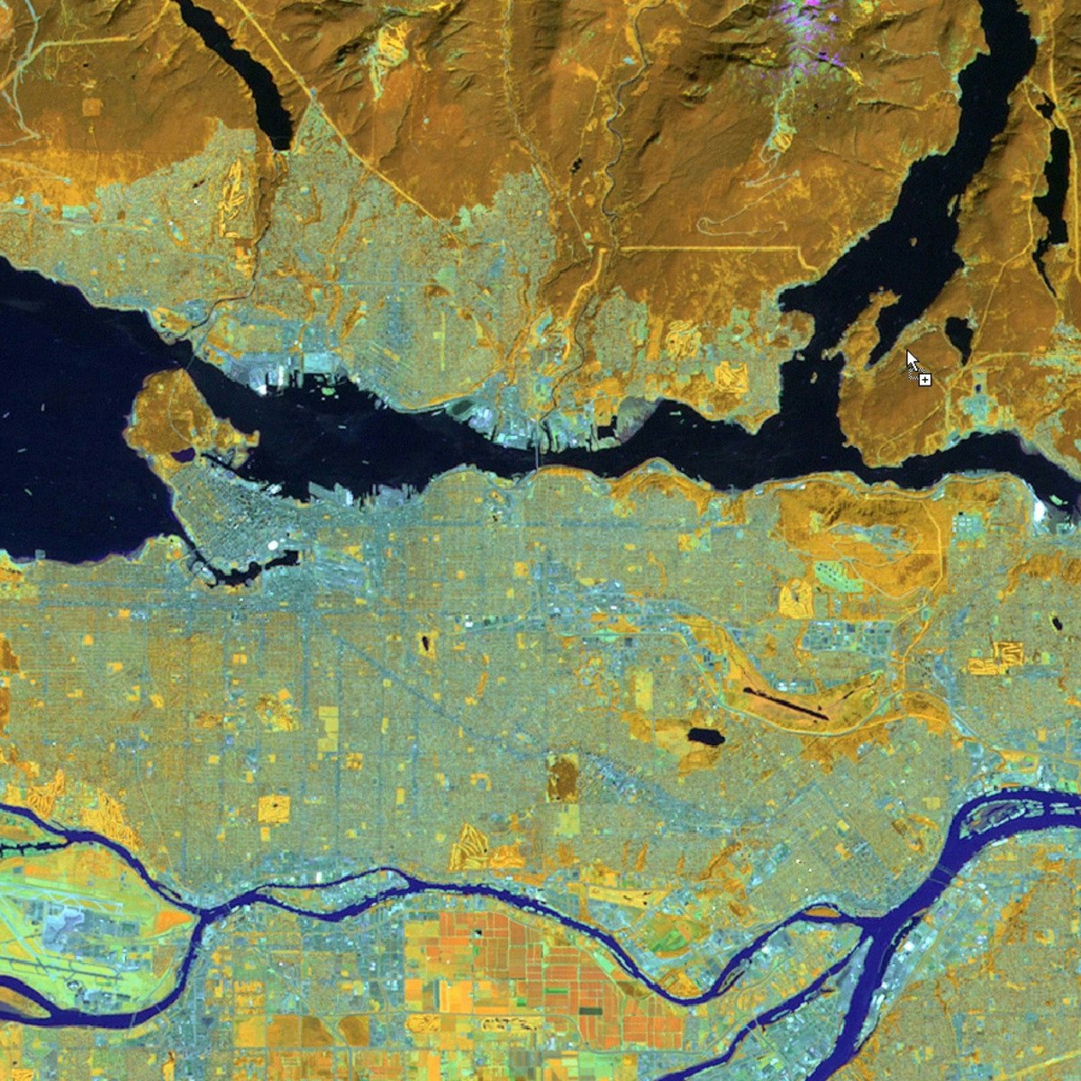
Remote sensing as a GIS data source
Read more

Traffic lights

Read about what's good
what should give you pause
and possible dealbreakers
Provides a foundation for GIS data analysis, which is a core skill for various industries and research fields
Introduces a range of data analysis methods, including vector analysis and raster analysis, which are essential for spatial problem-solving
Emphasizes practical application through hands-on project work, allowing learners to apply their newfound skills and knowledge
Covers a comprehensive range of topics, from data filtering and querying to remote sensing and raster analysis, providing a well-rounded understanding of GIS data analysis
Taught by Don Boyes, an experienced GIS professional and educator, who brings real-world expertise and insights to the course
Relies on learners to have access to their own software, which may pose a barrier for those without the necessary resources

Save this course

Create your own learning path. Save this course to your list so you can find it easily later.
Save

Reviews summary

Spatial analysis and satellite imagery essentials

According to learners, this course offers a solid foundation in spatial analysis and satellite imagery. Students particularly appreciate the final project which provides valuable practical application. The theoretical content covering topics like vector and raster analysis is often described as clear and well-explained. However, a recurring point of feedback, often expressed as a major weakness, is the quality and clarity of the hands-on labs. Many found the lab instructions confusing, outdated, or reliant on specific, potentially unsupported software versions, making practical application challenging for some. Despite lab difficulties, the core concepts are deemed valuable for understanding GIS principles.
Core concepts and principles are explained effectively.
"I learned so much about spatial analysis and working with satellite imagery. The lectures were clear and easy to follow."
"Solid course on spatial analysis fundamentals. It covers querying, vector analysis, and raster analysis effectively. The introduction to satellite imagery was also valuable."
"Fantastic course! I found the lectures engaging and the material very relevant to my work."
"A good overview of spatial analysis techniques. The course covers querying, vector and raster analysis, and satellite imagery basics. The theory parts are explained reasonably well."
"Excellent course for understanding the fundamental principles of spatial analysis."
The capstone project is highly praised for practical application.
"The final project was a great way to apply what I learned."
"The final project allowed me to integrate everything and work on a real-world problem."
"The final project was a highlight, providing much-needed practical experience."
"The final project is excellent for synthesizing knowledge."
"The final project is the best part."
"The final project is a great capstone."
Delivery style could be more engaging.
"The videos are a bit dry, and some explanations are not as clear as they could be."
"The lectures are boring and barely explain the concepts needed for the labs."
Lack of provided software leads to difficulties.
"Note: software is not provided for this course."
"It assumes you already know how to use the specific GIS software, which defeats the purpose."
"The software setup issues are also a pain point, as specific versions seem required but not provided or clearly specified."
Some course material and software examples are old.
"There were also a few outdated sections, particularly regarding software versions..."
"Very disappointed. The course material is outdated, especially the software examples."
"The labs are impossible to complete because the software and data links are broken or outdated."
"...they seem to rely on specific, possibly outdated software versions."
Hands-on exercises often lack clarity and guidance.
"The labs provided were lacking clarity. It felt like I had to spend a lot of time just trying to figure out how the labs were organized..."
"The labs were confusing at times, and I struggled to complete them without outside help."
"My main issue was with the lab exercises - they were often poorly explained or used datasets/software versions that didn't match the current state, causing frustration."
"However, the practical exercises (labs) are a major weak point. They are confusingly structured and don't always align well with the lecture material."
"However, the hands-on labs are frustrating. Instructions are unclear..."

Activities

Be better prepared before your course. Deepen your understanding during and after it. Supplement your coursework and achieve mastery of the topics covered in Spatial Analysis and Satellite Imagery in a GIS with these activities:
Read 'Getting to Know ArcGIS Desktop' by Michael Law
Gain a comprehensive understanding of ArcGIS Desktop, the software used in this course.
Show steps
  • Read through the chapters covering the basics of ArcGIS Desktop
  • Complete the exercises and examples provided in the book
Participate in a study group to discuss course topics
Engage with fellow students to exchange ideas, clarify concepts, and enhance your understanding.
Show steps
  • Join or form a study group with other course participants
  • Meet regularly to discuss course materials, assignments, and projects
  • Share perspectives, ask questions, and collaborate on problem-solving
Follow tutorials on spatial data analysis techniques
Enhance your proficiency in spatial data analysis by practicing with guided tutorials.
Browse courses on Spatial Data Analysis
Show steps
  • Identify relevant tutorials on data analysis techniques
  • Follow the tutorials step-by-step, applying the techniques to practice datasets
Three other activities
Expand to see all activities and additional details
Show all six activities
Complete practice exercises on data filtering and analysis
Strengthen your skills in data filtering and analysis through repetitive practice.
Browse courses on Data Filtering
Show steps
  • Find practice exercises or online quizzes on data filtering and analysis
  • Complete the exercises, paying attention to accuracy and efficiency
  • Review your answers and identify areas for improvement
Create a mind map summarizing GIS concepts
Solidify your understanding of GIS concepts by visually organizing them in a mind map.
Show steps
  • Identify the key concepts covered in the course
  • Use a mind mapping tool or software to create a diagram connecting the concepts
  • Add notes and examples to provide further context
Attend a workshop on advanced GIS techniques
Expand your knowledge and skills by attending a workshop focused on advanced GIS techniques.
Browse courses on Spatial Modeling
Show steps
  • Identify and register for a relevant workshop
  • Actively participate in the workshop, asking questions and taking notes
  • Apply the techniques learned in the workshop to your course projects

Career center

Learners who complete Spatial Analysis and Satellite Imagery in a GIS will develop knowledge and skills that may be useful to these careers:
Geospatial Analyst
Geospatial analysts use geographic information systems (GIS) to analyze and visualize data. Spatial Analysis and Satellite Imagery in a GIS may be useful in this role as it teaches you how to analyze map data using different data types and methods to answer geographic questions. This course can help you develop the skills you need to use GIS to solve problems and make decisions.
Spatial Data Scientist
Spatial data scientists use statistical and computational methods to analyze spatial data. Spatial Analysis and Satellite Imagery in a GIS may be useful in this role as it teaches you how to analyze map data using different data types and methods to answer geographic questions. This course can help you develop the skills you need to use spatial data to solve problems and make decisions.
GIS Analyst
GIS analysts use geographic information systems (GIS) to analyze and visualize data. Spatial Analysis and Satellite Imagery in a GIS may be useful in this role as it teaches you how to analyze map data using different data types and methods to answer geographic questions. This course can help you develop the skills you need to use GIS to solve problems and make decisions.
Remote Sensing Analyst
Remote sensing analysts use satellite imagery and other remotely sensed data to study the Earth's surface. Spatial Analysis and Satellite Imagery in a GIS may be useful in this role as it teaches you how to analyze map data using different data types and methods to answer geographic questions. This course can help you develop the skills you need to use remote sensing data to solve problems and make decisions.
GIS Manager
GIS managers oversee the use of geographic information systems (GIS) within an organization. Spatial Analysis and Satellite Imagery in a GIS may be useful in this role as it teaches you how to analyze map data using different data types and methods to answer geographic questions. This course can help you develop the skills you need to manage GIS projects and ensure that GIS is used effectively within your organization.
Cartographer
Cartographers create maps that represent geographical data. Spatial Analysis and Satellite Imagery in a GIS may be useful in this role as it teaches you how to analyze map data using different data types and methods to answer geographic questions. This course can help you develop the skills you need to create accurate and informative maps.
Geographer
Geographers study the Earth's surface and its human and natural environments. Spatial Analysis and Satellite Imagery in a GIS may be useful in this role as it teaches you how to analyze map data using different data types and methods to answer geographic questions. This course can help you develop the skills you need to conduct geographic research and solve real-world problems.
Land Surveyor
Land surveyors measure and map the Earth's surface. Spatial Analysis and Satellite Imagery in a GIS may be useful in this role as it teaches you how to analyze map data using different data types and methods to answer geographic questions. This course can help you develop the skills you need to conduct land surveys and create accurate maps.
Planning Analyst
Planning analysts develop and implement plans for the use of land and other resources. Spatial Analysis and Satellite Imagery in a GIS may be useful in this role as it teaches you how to analyze map data using different data types and methods to answer geographic questions. This course can help you develop the skills you need to conduct land use planning and environmental impact assessments.
Urban Planner
Urban planners develop and implement plans for the use of land and other resources in urban areas. Spatial Analysis and Satellite Imagery in a GIS may be useful in this role as it teaches you how to analyze map data using different data types and methods to answer geographic questions. This course can help you develop the skills you need to conduct land use planning and environmental impact assessments.
Water Resources Engineer
Water resources engineers design and manage water systems. Spatial Analysis and Satellite Imagery in a GIS may be useful in this role as it teaches you how to analyze map data using different data types and methods to answer geographic questions. This course can help you develop the skills you need to design and manage water systems that meet the needs of society and the environment.
Wildlife Biologist
Wildlife biologists study the behavior, ecology, and conservation of wildlife. Spatial Analysis and Satellite Imagery in a GIS may be useful in this role as it teaches you how to analyze map data using different data types and methods to answer geographic questions. This course can help you develop the skills you need to conduct wildlife research and conservation planning.
Map Librarian
Map librarians manage and provide access to maps and other geographic information resources. Spatial Analysis and Satellite Imagery in a GIS may be useful in this role as it teaches you how to analyze map data using different data types and methods to answer geographic questions. This course can help you develop the skills you need to organize and catalog maps and other geographic information resources.
Business Analyst
Business analysts use data to help businesses make decisions. Spatial Analysis and Satellite Imagery in a GIS may be useful in this role as it teaches you how to analyze map data using different data types and methods to answer geographic questions. This course can help you develop the skills you need to use data to identify opportunities and solve problems.
Data Analyst
Data analysts collect, clean, and analyze data to identify trends and patterns. Spatial Analysis and Satellite Imagery in a GIS may be useful in this role as it teaches you how to filter a data set using different types of queries to find just the data you need to answer a particular question. This course can help you develop the skills you need to work with large datasets and identify trends and patterns.

Reading list

We've selected 13 books that we think will supplement your learning. Use these to develop background knowledge, enrich your coursework, and gain a deeper understanding of the topics covered in Spatial Analysis and Satellite Imagery in a GIS.
A comprehensive textbook that covers the full range of GIS and science, from the basics to advanced topics. Useful as a reference source for more advanced topics.
An excellent start-up resource for learning more about the tools and techniques of GIS and putting them into practice. Goes over many of the core concepts and tools in the software and is full of color illustrations and helpful exercises.
A comprehensive textbook on geospatial analysis, covering a wide range of topics from basic to advanced. Useful as a reference source for more advanced topics.
A comprehensive guide to spatial regression models for the social sciences. Useful for those who want to learn more about this topic.
A comprehensive guide to using GIS for crime mapping and analysis. Useful for those who want to learn more about this topic.
A comprehensive guide to ArcGIS Pro, covering everything from basic tasks to advanced workflows. Useful as a reference source.
A concise and accessible textbook on spatial analysis, covering a wide range of topics from basic to advanced. Useful as a reference source for more advanced topics.
An excellent overview of the R programming language, as well as how to perform spatial data analysis using R. Useful for those who want to learn more about the programming side of GIS.
A step-by-step guide to ArcGIS Pro, covering a wide range of topics from basic to advanced. Useful for those who want to learn more about the software.
A hands-on guide to ArcGIS Pro, using a variety of case studies to teach the software. Useful for those who want to learn more about the software.
A comprehensive guide to working with satellite and aerial imagery in ArcGIS. Useful for those who want to learn more about this topic.

Share

Help others find this course page by sharing it with your friends and followers:

Similar courses

Similar courses are unavailable at this time. Please try again later.
Our mission

OpenCourser helps millions of learners each year. People visit us to learn workspace skills, ace their exams, and nurture their curiosity.

Our extensive catalog contains over 50,000 courses and twice as many books. Browse by search, by topic, or even by career interests. We'll match you to the right resources quickly.

Find this site helpful? Tell a friend about us.

Affiliate disclosure

We're supported by our community of learners. When you purchase or subscribe to courses and programs or purchase books, we may earn a commission from our partners.

Your purchases help us maintain our catalog and keep our servers humming without ads.

Thank you for supporting OpenCourser.

© 2016 - 2025 OpenCourser