We may earn an affiliate commission when you visit our partners.
Course image
Course image
Coursera logo

Clustering Geolocation Data Intelligently in Python

Ari Anastassiou

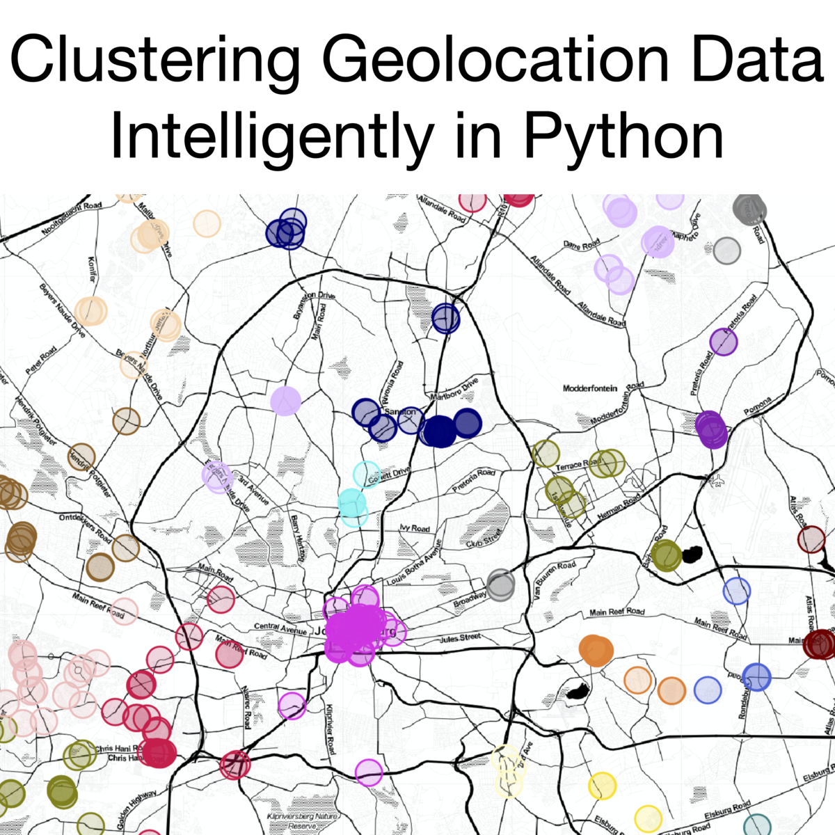
In this 1.5-hour long project, you will learn how to clean and preprocess geolocation data for clustering. You will learn how to export this data into an interactive file that can be better understood for the data. You will learn how to cluster initially with a K-Means approach, before using a more complicated density-based algorithm, DBSCAN. We will discuss how to evaluate these models, and offer improvements to DBSCAN with the introduction of HDBSCAN.

Read more

In this 1.5-hour long project, you will learn how to clean and preprocess geolocation data for clustering. You will learn how to export this data into an interactive file that can be better understood for the data. You will learn how to cluster initially with a K-Means approach, before using a more complicated density-based algorithm, DBSCAN. We will discuss how to evaluate these models, and offer improvements to DBSCAN with the introduction of HDBSCAN.

Note: This course works best for learners who are based in the North America region. We’re currently working on providing the same experience in other regions.

Enroll now

What's inside

Syllabus

Clustering Geolocation Data Intelligently in Python
In this 1.5-hour long project, you will learn how to visualize geolocation data clearly and interactively using Python. You will then learn a simple but limited approach to clustering this data, using the K-Means algorithm. We will develop on this notion of clustering by moving to more advanced density-based methods, namely Density-Based Spatial Clustering of Applications with Noise, known as DBSCAN, and in order to address some of its shortcomings, the more advanced Hierarchical DBSCAN (HDBSCAN). You will also learn about a simple method of addressing outliers that may exist in a clustering problem.

Good to know

Know what's good
, what to watch for
, and possible dealbreakers
Teaches skills and knowledge that are relevant for understanding the real-world application of data through visualization and clustering
Develops essential skills for data analysis, which can be valuable in many fields and industries
Provides hands-on experience with data cleaning, preprocessing, and clustering techniques
Covers a range of clustering algorithms, including K-Means and DBSCAN, which provides a comprehensive understanding of different approaches
Introduces HDBSCAN, an advanced clustering algorithm that addresses limitations of DBSCAN
Involves the use of Python, which is a widely adopted language for data science and machine learning

Save this course

Save Clustering Geolocation Data Intelligently in Python to your list so you can find it easily later:
Save

Reviews summary

Well-received clustering course

Learners say this clustering geolocation data course in Python is good, excellent, well-explained, practical, and informative. The hands-on project is well-received and provides engaging assignments that utilize Python libraries and algorithms like k-means, DBSCAN, and HDBSCAN. One potential issue is that the cloud desktop may slow down, so students may want to use their personal devices instead.
The course is beginner-friendly and easy to follow.
"Good project which is based on python and interesting."
"Nice way to learn new things and how to implement them"
"It is very interactive and informative course."
The explanations are clear and well-explained.
"Good explanations !"
"I thoroughly enjoyed the course divided in chunks."
"Very good approaches ! Congratulations !"
The hands-on project is well-received.
"Nice hands on project experience"
"Excellent Course on Geolocation"
"Nice hands-on course to get introduced with the some popular clustering approaches"
There is a time limit for the project.
"It would be better if there was no time limit to the project on VM"
The cloud desktop may slow down, so using a personal device is recommended.
"The cloud Desktop Rhyme was slowing down."
"It would be better if there was no time limit to the project on VM as the VM was too slow."
"Course is amazing in terms of content, professor's instructions, and exercises. However, the tool used in this course is quite slow and actually messed up my most of time."

Activities

Coming soon We're preparing activities for Clustering Geolocation Data Intelligently in Python. These are activities you can do either before, during, or after a course.

Career center

Learners who complete Clustering Geolocation Data Intelligently in Python will develop knowledge and skills that may be useful to these careers:
Geospatial Analyst
As a Geospatial Analyst, you will analyze and interpret geospatial data to help organizations make informed decisions. This course will help you build a solid foundation in using Python for geospatial data analysis, which is an essential skill for this role. You will learn how to clean and preprocess geolocation data for clustering, and how to use different clustering algorithms to identify patterns and trends in the data. This course will also introduce you to the concept of outliers and how to address them in a clustering problem.
Urban Planner
As an Urban Planner, you will design and plan the use of land and resources in urban areas. This course will help you build a foundation in using Python for geospatial data analysis, a valuable skill for this role. You will learn how to clean and preprocess geolocation data for clustering, and how to use different clustering algorithms to identify patterns and trends in the data. This information will be critical for making informed decisions about land use and resource allocation.
Transportation Planner
As a Transportation Planner, you will plan and design transportation systems, including roads, highways, and public transportation. This course will help you build a foundation in using Python for geospatial data analysis, which is a valuable skill for this role. You will learn how to clean and preprocess geolocation data for clustering, and how to use different clustering algorithms to identify patterns and trends in the data. This will help you understand travel patterns and make decisions about how to improve transportation systems.
Data Scientist
As a Data Scientist, you will use data to solve business problems and make predictions. This course will help you build a foundation in using Python for data analysis, including geospatial data analysis. You will learn how to clean and preprocess geolocation data for clustering, and how to use different clustering algorithms to identify patterns and trends in the data. This will help you develop models and make predictions that can help businesses make better decisions.
GIS Analyst
As a GIS Analyst, you will use geographic information systems (GIS) to analyze and visualize data. This course will help you build a foundation in using Python for geospatial data analysis, a valuable skill for this role. You will learn how to clean and preprocess geolocation data for clustering, and how to use different clustering algorithms to identify patterns and trends in the data. This will help you create maps and other visualizations that communicate complex geospatial information clearly and effectively.
Cartographer
As a Cartographer, you will create maps and other visualizations to communicate geospatial information. This course will help you build a foundation in using Python for geospatial data analysis. You will learn how to clean and preprocess geolocation data for clustering, and how to use different clustering algorithms to identify patterns and trends in the data. This will help you create maps and other visualizations that are clear, accurate, and informative.
Spatial Statistician
As a Spatial Statistician, you will use statistical methods to analyze spatial data. This course will help you build a foundation in using Python for geospatial data analysis. You will learn how to clean and preprocess geolocation data for clustering, and how to use different clustering algorithms to identify patterns and trends in the data. This will help you develop models that can be used to make predictions and inform decision-making.
Business Analyst
As a Business Analyst, you will use data to analyze business problems and make recommendations for improvement. This course will help you build a foundation in using Python for data analysis, including geospatial data analysis. You will learn how to clean and preprocess geolocation data for clustering, and how to use different clustering algorithms to identify patterns and trends in the data. This will help you develop insights that can help businesses make better decisions.
Operations Research Analyst
As an Operations Research Analyst, you will use mathematical and analytical methods to solve business problems. This course will help you build a foundation in using Python for data analysis, including geospatial data analysis. You will learn how to clean and preprocess geolocation data for clustering, and how to use different clustering algorithms to identify patterns and trends in the data. This will help you develop models and make recommendations that can help businesses improve their operations.
Epidemiologist
As an Epidemiologist, you will study the distribution and determinants of health-related states or events in a population. This course can be useful in helping you understand the spatial distribution of diseases and other health-related factors. You will learn how to clean and preprocess geolocation data for clustering, and how to use different clustering algorithms to identify patterns and trends in the data. This can help you identify areas at high risk for disease and develop interventions to prevent or control outbreaks.
Market Researcher
As a Market Researcher, you will conduct research to understand consumer behavior and market trends. This course will help you build a foundation in using Python for data analysis, including geospatial data analysis. You will learn how to clean and preprocess geolocation data for clustering, and how to use different clustering algorithms to identify patterns and trends in the data. This will help you understand customer behavior and make informed decisions about marketing strategies.
Crime Analyst
As a Crime Analyst, you will use data to analyze and understand crime patterns. This course will help you build a foundation in using Python for data analysis, including geospatial data analysis. You will learn how to clean and preprocess geolocation data for clustering, and how to use different clustering algorithms to identify patterns and trends in the data. This can help you identify crime hot spots and develop strategies to prevent crime.
Environmental Scientist
As an Environmental Scientist, you will study the environment and its interaction with humans. This course can be useful in helping you understand the spatial distribution of environmental hazards and resources. You will learn how to clean and preprocess geolocation data for clustering, and how to use different clustering algorithms to identify patterns and trends in the data. This can help you develop policies and strategies to protect the environment.
Geographer
As a Geographer, you will study the physical and human geography of the Earth. This course can be useful in helping you understand the spatial distribution of people, places, and resources. You will learn how to clean and preprocess geolocation data for clustering, and how to use different clustering algorithms to identify patterns and trends in the data. This can help you develop a deeper understanding of the world around you.
Geologist
As a Geologist, you will study the Earth's physical structure and history. This course can be useful in helping you understand the spatial distribution of geological features. You will learn how to clean and preprocess geolocation data for clustering, and how to use different clustering algorithms to identify patterns and trends in the data. This can help you develop models that can be used to locate valuable resources and understand the Earth's history.

Reading list

We've selected seven books that we think will supplement your learning. Use these to develop background knowledge, enrich your coursework, and gain a deeper understanding of the topics covered in Clustering Geolocation Data Intelligently in Python.
Provides a comprehensive overview of spatial clustering algorithms, including a chapter on DBSCAN.
Provides a comprehensive overview of clustering algorithms, including both k-means and DBSCAN.
Provides a comprehensive overview of machine learning for spatial data, including a chapter on clustering.

Share

Help others find this course page by sharing it with your friends and followers:
Our mission

OpenCourser helps millions of learners each year. People visit us to learn workspace skills, ace their exams, and nurture their curiosity.

Our extensive catalog contains over 50,000 courses and twice as many books. Browse by search, by topic, or even by career interests. We'll match you to the right resources quickly.

Find this site helpful? Tell a friend about us.

Affiliate disclosure

We're supported by our community of learners. When you purchase or subscribe to courses and programs or purchase books, we may earn a commission from our partners.

Your purchases help us maintain our catalog and keep our servers humming without ads.

Thank you for supporting OpenCourser.

© 2016 - 2024 OpenCourser