May 1, 2024
Updated May 11, 2025
20 minute read
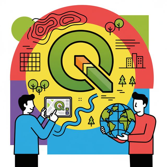
QGIS, formerly known as Quantum GIS, is a free and open-source Geographic Information System (GIS) that empowers users to create, edit, visualize, analyze, and publish geospatial data. It runs on various operating systems, including Windows, macOS, Linux, and even Android (through third-party applications). Think of it as a versatile digital mapping and spatial analysis toolbox, accessible to anyone with a computer and an interest in understanding the "where" of their data.
Working with QGIS can be an engaging and exciting endeavor for several reasons. Firstly, its open-source nature means it's constantly evolving through a global community of developers, offering cutting-edge tools without the often-hefty price tag of proprietary software. This accessibility opens doors for students, researchers, non-profits, and businesses alike. Secondly, QGIS allows you to unravel spatial patterns and relationships in data that might otherwise remain hidden. Imagine visualizing the spread of a disease, planning the most efficient delivery routes, or identifying areas vulnerable to climate change – these are the kinds of powerful insights QGIS can help uncover. Finally, the ability to create compelling maps and visualizations offers a powerful way to communicate complex information effectively, making it a valuable skill in a wide range of fields.
Introduction to QGIS: Overview and Core Concepts
This section provides a foundational understanding of QGIS, its history, core capabilities, and how it positions itself in the broader GIS software landscape. We aim to provide enough information for you to grasp the essence of QGIS and its potential applications.
What Exactly is QGIS?
5gcygb|
Find a path to becoming a QGIS. Learn more at:
OpenCourser.com/topic/5gcygb/qgi
Reading list
We've selected 35 books
that we think will supplement your
learning. Use these to
develop background knowledge, enrich your coursework, and gain a
deeper understanding of the topics covered in
QGIS.
This workbook is designed for both classroom use and independent study, providing a comprehensive introduction to QGIS 3.x. It covers basic GIS concepts, spatial analysis, data management, and cartographic design through hands-on exercises. is highly valuable for beginners and those transitioning from other GIS software, serving as a practical guide to solidify fundamental QGIS skills. It is commonly used as a textbook in academic settings.
Series is designed for beginners, offering a step-by-step practical tutorial to get started with QGIS 3. It covers basic skills like navigating maps, working with tables, and thematic mapping, making it very accessible for newcomers.
Provides a solid introduction to QGIS, covering the interface, working with vector and raster data, using plugins, the Processing Toolbox, georeferencing, and creating maps. It's an excellent resource for beginners to gain a broad understanding of QGIS capabilities. The book includes data to follow along with chapters and is useful for self-study.
A comprehensive Chinese-language textbook on GIS, covering the basics of GIS, data acquisition, analysis, and visualization.
Is an in-depth guide for becoming proficient in spatial data analysis using QGIS 3.x with Python. It's aimed at users who want to master geospatial development and utilize the full potential of QGIS through scripting and advanced techniques.
This cookbook provides recipes for automating geoprocessing tasks in QGIS using Python. It's ideal for users with programming experience who want to extend QGIS functionality and create custom workflows. It's a valuable reference for anyone interested in the Python API for QGIS.
This guide is specifically for those who want to program with QGIS using Python (PyQGIS). It covers understanding the QGIS API, writing scripts, and building plugins. It's a technical book best suited for users with Python experience looking to customize and extend QGIS.
A comprehensive guide to using QGIS for geospatial analysis, covering topics such as data management, spatial analysis, and visualization.
Focused on hydrological applications, this book provides practical recipes for using QGIS in catchment hydrology and water management. It's valuable for students and professionals in environmental science and hydrology, offering domain-specific QGIS skills and workflows. It includes exercises and links to video materials for enhanced learning.
This guide provides a step-by-step approach to getting started with QGIS, covering loading data, creating data, styling, and making maps. It's a good resource for absolute beginners to quickly gain confidence with the software interface and basic functions.
This guide focuses on using QGIS for working with satellite imagery and remote sensing data. It's particularly relevant for courses involving remote sensing and environmental monitoring, demonstrating how to process and analyze satellite data within QGIS.
Focuses on mastering data management, visualization, and spatial analysis techniques to become a proficient QGIS user. It's aimed at those who want to move beyond the basics and leverage the full capabilities of QGIS for various GIS tasks.
A collection of recipes for solving common GIS tasks using QGIS, covering topics such as data management, spatial analysis, and cartography.
As the official QGIS Training Manual, this book provides a comprehensive introduction to Quantum GIS (older versions are referred to as Quantum GIS). It foundational text for anyone starting with QGIS and is considered a classic resource for building a solid understanding of the software's core functionalities. While based on an older version (1.8), the fundamental concepts remain relevant.
This textbook uses 16 case studies related to Sustainable Development Goals to teach GIS concepts and methodologies with QGIS. It's an excellent resource for students and educators looking to learn GIS through real-world problems and applications, covering fundamentals to more advanced analysis.
Aimed at intermediate and advanced users, this book delves deeper into QGIS capabilities, covering advanced data management, visualization, and spatial analysis techniques. It's a good resource for those looking to become power users and transition from proprietary GIS software. While the second edition is older, it provides a solid foundation for advanced concepts.
Is tailored for ecologists and environmental scientists, guiding them on using QGIS for creating maps for ecological surveys and reports. It's a practical guide with no jargon, focusing on the specific mapping needs of this field.
Aims to provide a complete beginner's guide to QGIS Desktop, covering the basics, working with data, styling, and creating maps. It includes a working project to help solidify understanding of fundamental GIS and cartography concepts in QGIS.
Leverages real-world applications to demonstrate the power of QGIS in cartography and GIS analysis. It's a good resource for users who prefer learning through practical examples and want to see how QGIS can be applied to solve actual geospatial problems.
Explores geospatial analysis using a combination of R and QGIS. It's suitable for users interested in leveraging the statistical capabilities of R within a GIS workflow. It provides practical examples for real-world projects.
Focuses on geospatial analysis using Python, with practical techniques applicable to GIS and remote sensing. While not exclusively about QGIS, it's highly relevant for users who want to integrate Python scripting with QGIS for advanced analysis and automation.
Teaches the basics of mapping for ecological projects using QGIS. It guides beginners through creating various maps commonly used in ecological reports and surveys, and includes downloadable data for practice. Published in October 2024, it covers contemporary workflows relevant to ecologists.
Focuses on using QGIS in conjunction with Mergin Maps for field data collection and management. It's a valuable resource for anyone involved in fieldwork and mobile data collection using QGIS.
Guides users through viewing, editing, and analyzing geospatial data in QGIS, including an introduction to Python scripting for QGIS. It's suitable for beginners and those looking to expand their skills beyond the basics. While slightly older, the fundamental concepts remain relevant, although newer editions or supplementary resources may be needed for the latest QGIS versions.
For more information about how these books relate to this course, visit:
OpenCourser.com/topic/5gcygb/qgi