March 29, 2024
Updated May 12, 2025
18 minute read
A Career Guide to Becoming a Remote Sensing Scientist
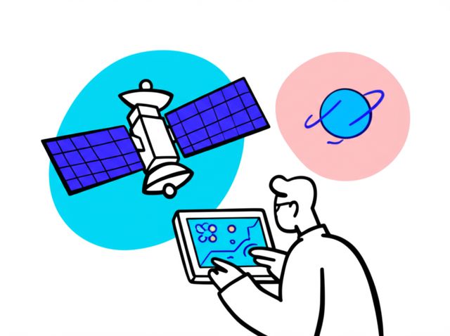
Remote sensing science is a field dedicated to gathering information about the Earth's surface and atmosphere from a distance, typically using sensors mounted on satellites, aircraft, or drones. It combines principles from physics, geography, computer science, and various environmental sciences to analyze data and solve real-world problems. Remote sensing scientists play a critical role in understanding our planet, monitoring environmental changes, managing natural resources, and planning for the future.
Working as a remote sensing scientist offers the chance to engage with cutting-edge technology and tackle significant global challenges. Imagine using satellite imagery to track deforestation in the Amazon, applying advanced algorithms to predict crop yields, or employing LiDAR technology to map coastal erosion. The field provides opportunities to contribute to diverse areas like climate change monitoring, disaster management, urban planning, and even national security.
s3xuc0|
Find a path to becoming a Remote Sensing Scientist. Learn more at:
OpenCourser.com/career/s3xuc0/remote
Featured in The Course Notes
This career is mentioned in our blog,
The Course Notes. Read
one article that features
Remote Sensing Scientist:
To read more articles from OpenCourser, visit:
OpenCourser.com/notes
Reading list
We haven't picked any books for this reading list yet.
Provides a practical guide to using ecosystem mapping for natural resource management, including examples of successful applications.
This comprehensive encyclopedia provides a detailed overview of the field of ecology, including sections on ecosystem mapping and analysis.
Provides a comprehensive overview of ecosystem mapping, including the history, methods, and applications of this technique. It valuable resource for anyone interested in understanding and managing ecosystems.
Provides a comprehensive overview of radiometry, covering the fundamental principles of electromagnetic radiation, the interaction of radiation with matter, and the design and use of optical detectors. It valuable resource for students and researchers in optics, physics, and engineering.
Provides a comprehensive overview of landscape ecological mapping, a method used to create maps of the spatial distribution of ecosystems and their components at the landscape scale.
This textbook provides a comprehensive overview of the principles and applications of geographic information systems (GIS), including their use in ecosystem mapping.
This textbook provides a comprehensive overview of the principles and applications of remote sensing, a technology used to collect data about the Earth's surface from satellites and aircraft, including its use in ecosystem mapping.
Provides a comprehensive overview of the different technologies used in cartography and GIS. It covers a wide range of topics, including the history of cartography and GIS, the different types of maps and GIS data, and the use of cartography and GIS in different applications.
Provides a comprehensive overview of the theory and practice of cartographic relief presentation. It covers a wide range of topics, including the history of cartographic relief presentation, the different methods of cartographic relief presentation, and the use of cartographic relief presentation in different applications.
Provides a comprehensive overview of the different technologies used in digital mapping. It covers a wide range of topics, including the different types of digital maps, the use of GIS in digital mapping, and the use of remote sensing in digital mapping.
Provides a comprehensive overview of the different techniques used in spatial data analysis. It covers a wide range of topics, including the different types of spatial data, the different methods of spatial data analysis, and the use of spatial data analysis in different applications.
Provides a comprehensive overview of the different techniques used in geocomputation. It covers a wide range of topics, including the different types of geospatial data, the different methods of geocomputation, and the use of geocomputation in different applications.
Provides a comprehensive overview of the different techniques used in web mapping. It covers a wide range of topics, including the different types of web maps, the different methods of web mapping, and the use of web mapping in different applications.
Provides a comprehensive overview of the different techniques used in spatial analysis and geocomputation. It covers a wide range of topics, including the different types of spatial data, the different methods of spatial analysis and geocomputation, and the use of spatial analysis and geocomputation in different applications.
Provides a comprehensive overview of the history of cartography. It covers a wide range of topics, including the development of map projections, the use of maps in different cultures, and the impact of cartography on society.
Provides a concise and accessible introduction to the fundamental principles of radiometry and photometry. It valuable resource for students and researchers in optics, physics, and engineering.
Is intended for the non-specialist who wants a broad overview of the principles, equipment, and applications of remote sensing by satellite. This easy-to-understand and comprehensive text introduces readers to the basics of satellite remote sensing, from the physical principles and characteristics of sensors to data acquisition and interpretation.
Provides a broad overview of the principles and applications of remote sensing. It valuable resource for students and researchers in remote sensing, geography, and environmental science.
Provides a comprehensive overview of radar remote sensing of the Earth, with a focus on the theory and applications of this technology. It valuable resource for students and researchers in remote sensing, geology, and environmental science.
For more information about how these books relate to this course, visit:
OpenCourser.com/career/s3xuc0/remote
